Current Work:
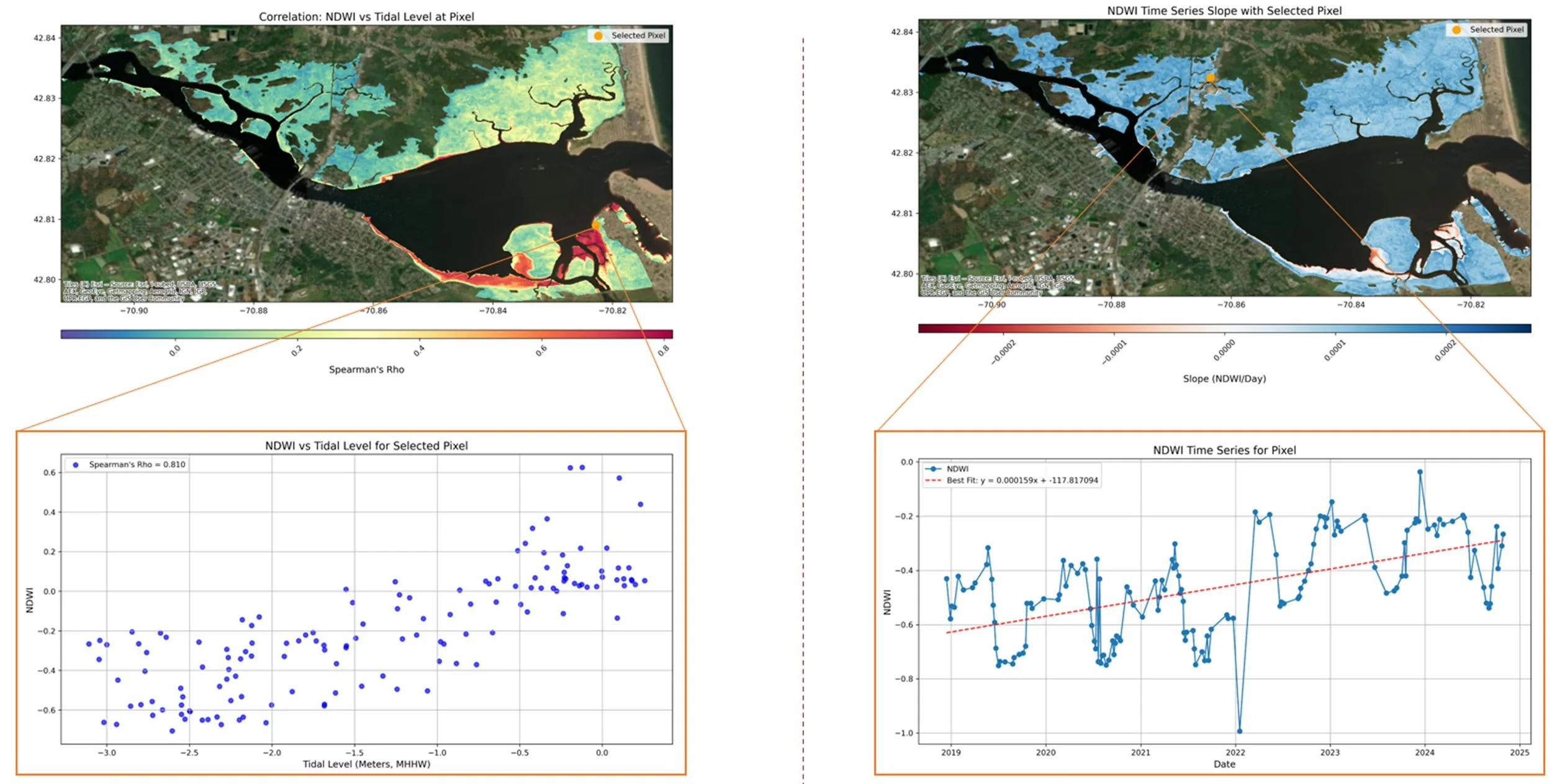
As a Postdoctoral Research Associate at University of Massachusetts, I work with a team of UMass scientists, and marsh scientists and practitioners statewide, to optimize the monitoring of the state’s salt marshes and evaluate restoration project efficacy.
I use satellite remote sensing and aerial imagery, paired with environmental monitoring and field data, to identify physical trends, change points, and tipping points.
Past work:
Speiser, W. H., Largier, J. L., & Buscombe, D. (2025). Cross‐shore dispersion of turbid waters by wave‐driven nearshore flows: Remote sensing of rip currents off rocky and sandy shores. Journal of Geophysical Research: Oceans, 130(11), e2025JC022833.
Speiser, William H., and John L. Largier. "Long-term observations of the turbid outflow plume from the Russian River, California." Estuarine, Coastal and Shelf Science 309 (2024): 108942.
Speiser, William H., and John L. Largier. "High-Resolution Nearshore Sea Surface Temperature from Calibrated Landsat Brightness Data." Remote Sensing 16.23 (2024): 4477.


